Seismic Tomography
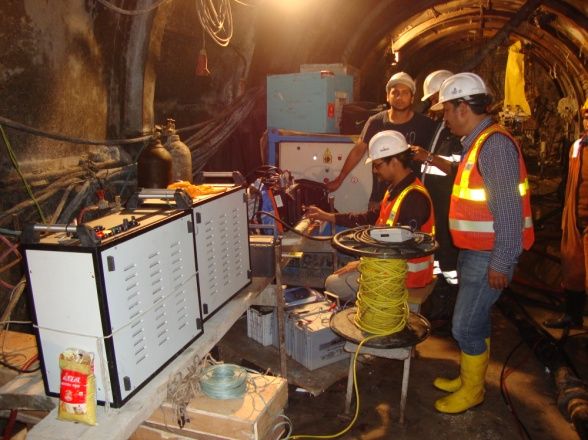
Seismic Tomography is similar to CAT Scanning used in Medical science. This is an advanced and increasingly utilized technique in engineering geophysics offering high-resolution insights into subsurface conditions. It is particularly effective for evaluating the engineering properties of soil and rock masses, which is crucial for the design and construction of underground structures such as caverns and foundations. The method is typically implemented between two boreholes, where a sparker source generates seismic waves and high-frequency hydrophones or geophones are used to record the responses.
This technique provides point-by-point reconstruction of seismic wave velocities within the scanned volume, enabling detailed interpretation of geological features. It is capable of accurately determining in-situ compressional and shear wave velocities, assessing rock mass quality, calculating dynamic elastic parameters, mapping bedrock profiles, and defining subsurface stratigraphy.
Seismic tomography is especially valuable for areas where conventional methods like seismic refraction or reflection may be limited due to complex subsurface conditions. For example, it can be effectively used to image the foundation zone of a dam from riverbanks, thereby avoiding the need for difficult and expensive drilling in the riverbed.
One of the key advantages of seismic tomography is that it does not require assumptions about the subsurface structure beforehand. This makes it highly suitable for investigating geologically complex areas. Additionally, it provides a continuous velocity map of the investigated section, delivering more comprehensive and detailed subsurface information than traditional seismic methods.
Applications of Seismic Tomography
- Geological structure characterization
- Investigation of power house caverns of Hydropower & PSP projects
- Assessment of concrete quality of existing dams
- Assessment of sub surface geological conditions along the metro tunnel route
- Hydrogeological studies
- Geotechnical studies
- Engineering site investigations
- Efficacy of grouting
- Detection of fractures and faults
- Evaluation of ground stability
- Assessment of seismic hazard
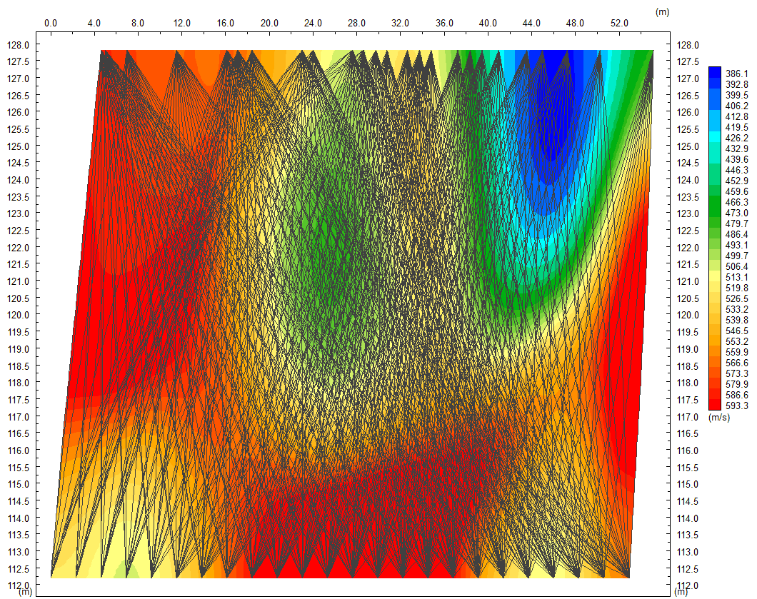
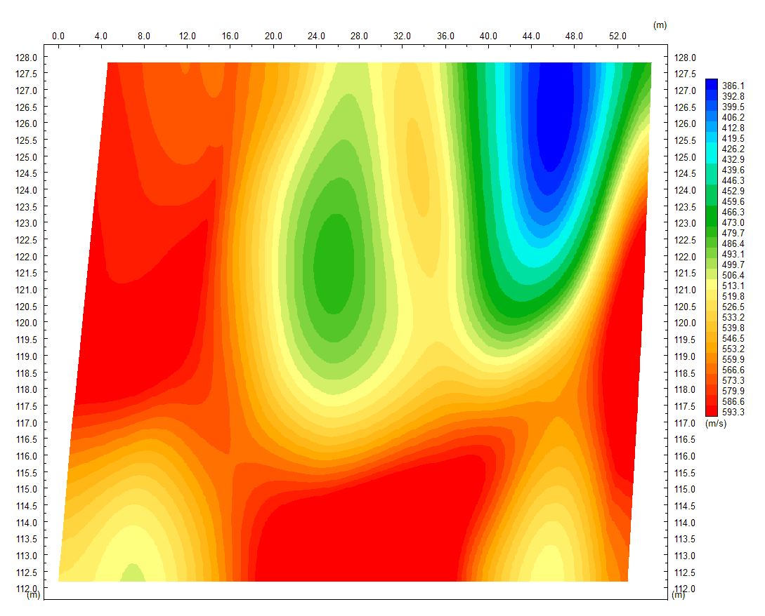
Seismic Tomography results
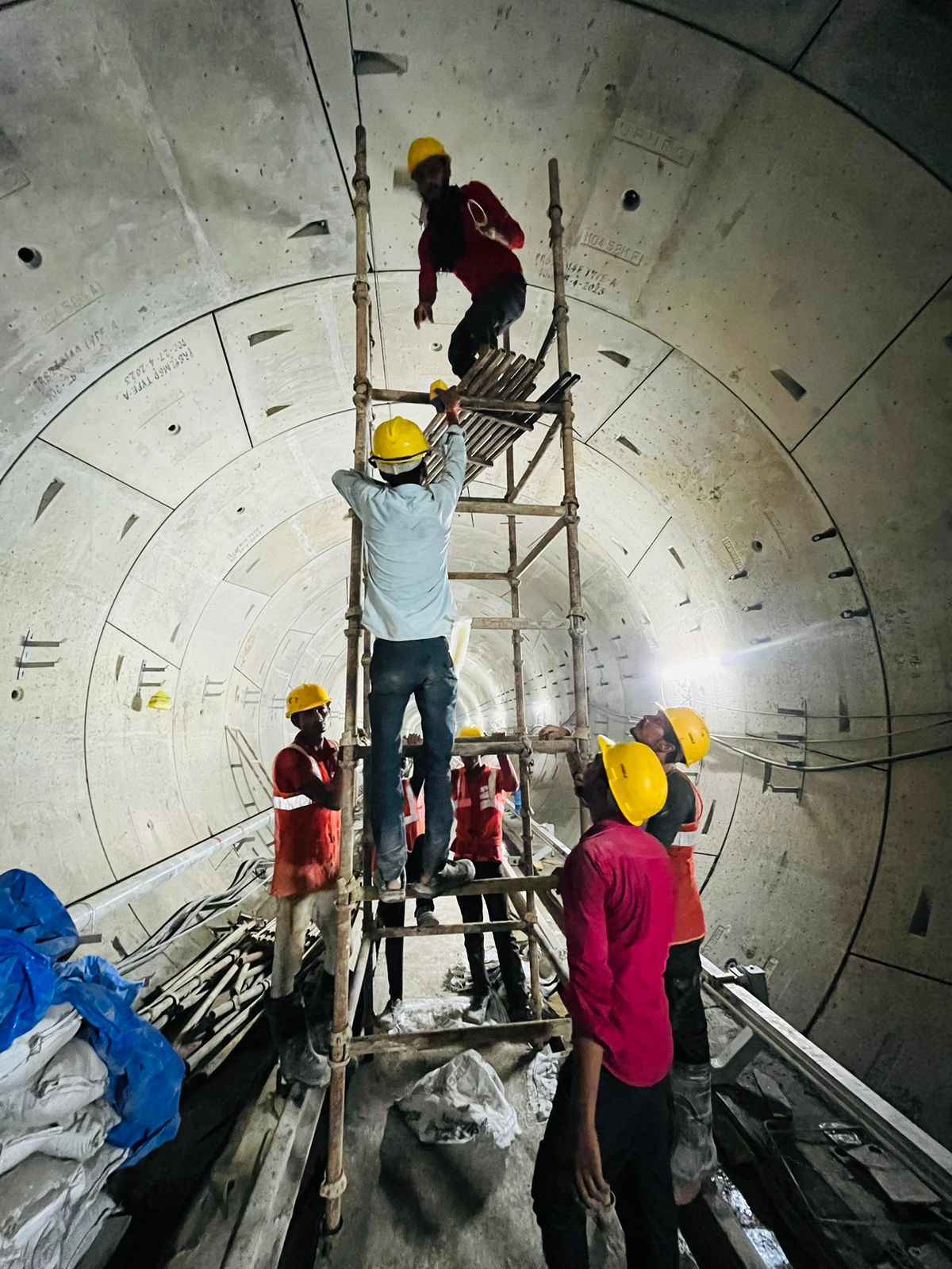
Our Gallery
Our Clients