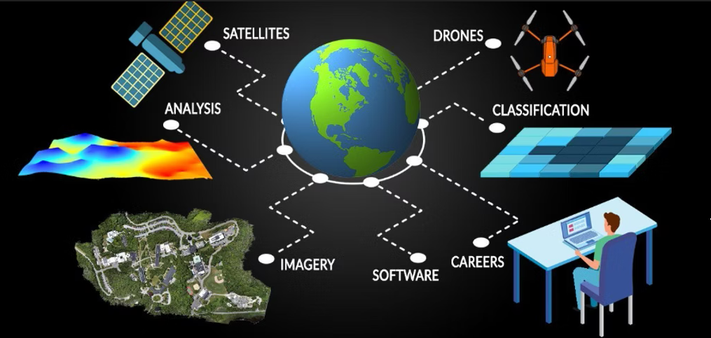
Remote Sensing GIS & Topography Survey
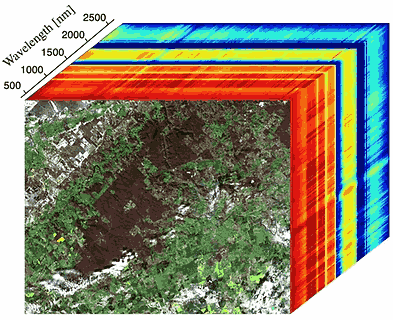
Remote Sensing, GIS, and Topographic Surveys are essential technologies for analyzing and understanding the Earth’s surface and environment. Remote sensing involves capturing imagery of the Earth using sensors mounted on satellites, aircraft, or drones. These images provide valuable information about land cover, vegetation, urban development, and even environmental pollution.
Geographic Information Systems (GIS) serve as a powerful platform to store, analyze, and visualize spatial data. GIS integrates information from remote sensing with other datasets—such as infrastructure, population, or terrain data—to support informed decision-making in areas like urban planning, resource management, and disaster response.
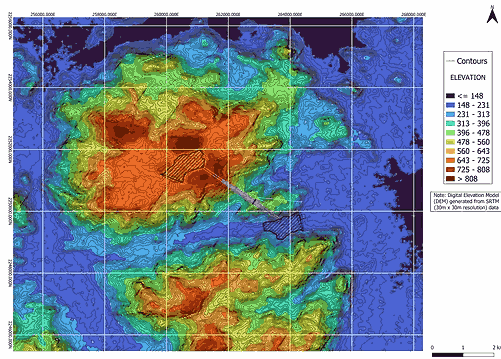
Topographic surveys focus on accurately mapping the physical features of the land, including elevations, slopes, rivers, and man-made structures. Using precise instruments, surveyors document the terrain’s shape and relief to produce detailed topographic maps.
When combined, remote sensing, GIS, and topographic surveys provide a comprehensive view of the environment. These tools enable professionals to plan infrastructure projects, monitor changes in ecosystems, and assess risks such as flooding. Together, they support smarter, data-driven decisions for sustainable development and environmental management.
Applications of Remote sensing and GIS
- Land Use Planning
- Environmental Monitoring
- Infrastructure Development
- Planning for Hydro and PSP projects
- Disaster Risk Assessment
- Precision Agriculture
- Asset Management
- Hydrology
- Land degradation
- Road networking
- Waste water and storm water systems
- Waste management
- Change detection
- Spectral analysis
- Image classification
- Wetland management
- Wasteland mapping
Our Clients