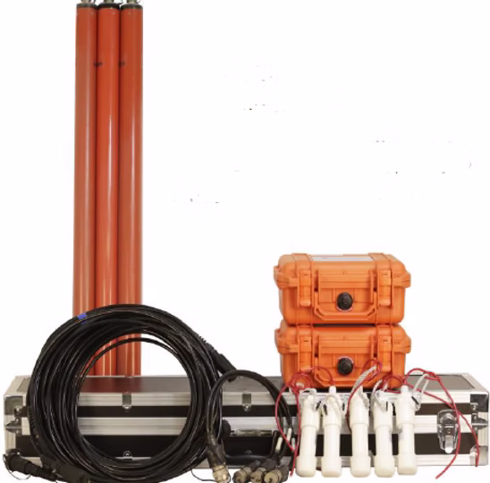
Magneto telluric Acquisition
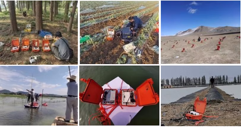
The GSEM series products utilize advanced power and electronic circuit technologies, offering high precision, low power consumption, strong anti-interference capabilities, lightweight design, and extended networking range. The GSEM series data acquisition stations are compatible with a wide range of external sensors and support multiple geophysical methods, including MT, AMT, and CSAMT. Equipped with long-range wireless sensor technology, they enable self-organizing networks and distributed deployments, even in mountainous terrain. This allows for cost-effective, large-scale 2D and 3D geophysical surveys.
Technical Parameter
| Receiver | |
|---|---|
| Specification | Detail |
| Input Signal Range: | ±1.25V |
| Input impedance | 1MΩ |
| Gain | 0.1, 1, 3, 15, 25, 45, 81 optional (AMT) 0.1, 1, 4, 16, 64 optional (MT/LMT) |
| Frequency | 0.1 ~ 10000Hz (AMT), 0.0001 ~ 1000Hz (MT) |
| Dynamic Range | 160dB |
| Sensors | CMS-01, CMS-02 (support Phoenix Mag Sensors) |
| Background Noise: | 3 nV / sqrt(Hz) @ 1000Hz AMT 5 nV / sqrt(Hz) @ 1Hz MT |
| Synchronization: | ±30ns |
| Connection: | Wi-Fi, Zigbee, Internet |
| Channel: | 5 (Ex, Ey, Hx, Hy, Hz) |
| Sample Rate: | 24000Hz, 2400Hz, 150Hz |
| Notch Filter: | 50/60Hz odd Notch Filter and |
| Communicate Distance: | 1600m @ Visual Condition via ZigBee |
| Max Station: | 256 @ ZigBee |
| Power supply | Powered by a power bank |
| Weight | <3kg |
| Dimension | 27 × 24.6 × 12.4cm |
| Power dissipation | <2.5W |
| Operating temperature | -40°C ~ 60°C |
Applications
- Mineral exploration including identify ore bodies such as copper, gold, map alteration zones detects hydrothermal systems, deep targeting.
- Oil & Gas Exploration including resistivity mapping, basement mapping.
- Geothermal Energy including reservoir characterization, fault detection, exploration in volcanic terrains which is effective in areas with complex geology.
- Environmental & Groundwater study including contamination studies, hydrogeological modelling.
- Tectonic & Crustal studies including crust & upper mantle imaging that reveals tectonic structures, lithospheric boundaries, earthquake research which investigates fault zones and fluid movement, plate tectonics helps understand continental collision & rifting process.
- Infrastructure & Engineering including site assessment which evaluates subsurface conditions in tunnels, dams, Landslide & Hazard analysis.
Our Clients